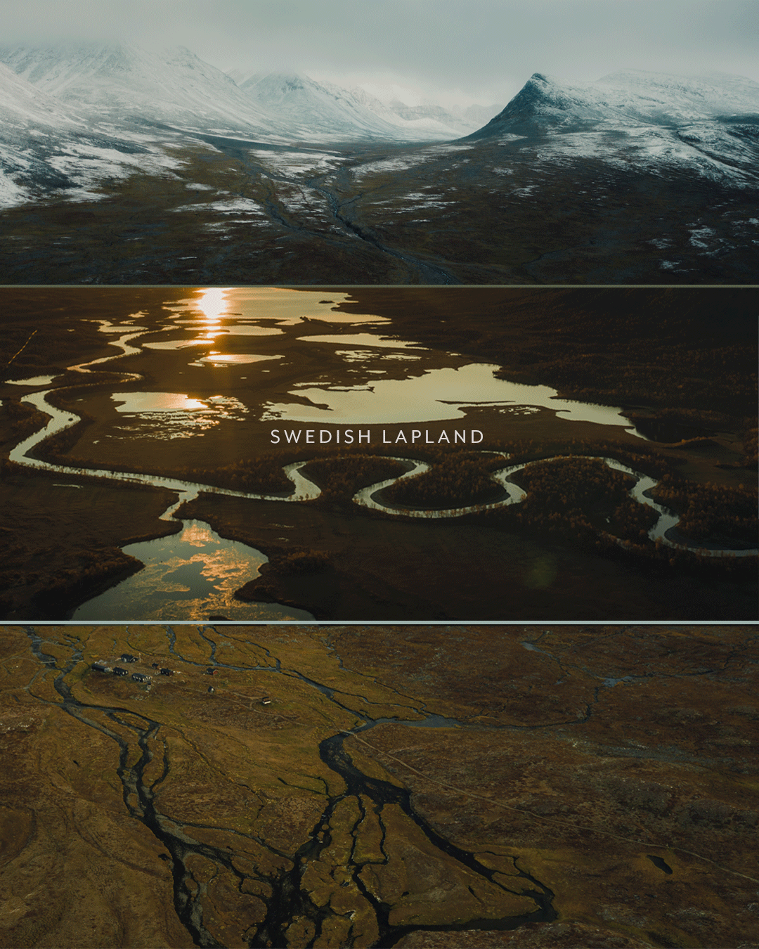
Photographing Swedish Lapland by fall
Huts covered: Nallo - Sälka - Singi - Kebnekaise - Nikkaluokta
Distance covered: 55km (34.2 miles)
Time period: September 18-22
My colleague Jacob and I took the 1.5 hour flight from Stockholm to Kiruna Airport where we got picked up by a cab. The one-hour car ride was going to take us to the starting point of our trip, Nikkaluokta, where the public road ends. The cab driver happened to be one of the ancestors to the person who named the tiny Sami village Nikkaluokta, which translates to “The bay of Nils” or “Nilsviken” in Swedish.
As we approached Nikkaluokta some of the highest mountains in Sweden towered around us with their white tops and brown slopes. The temperature was around 1 degrees Celsius (33,8 Fahrenheit) and a mix of snow and rain was whirling in the air. By the time we got to Nikkaluokta we already had a reindeer encounter and the excitement for the days to come was real.
The huts covered in this article are open June 12 - Sept 22. Note that the majority of the huts don’t have running water, but a lot of them have saunas and some have stores with lighter food and some hiking necessities.
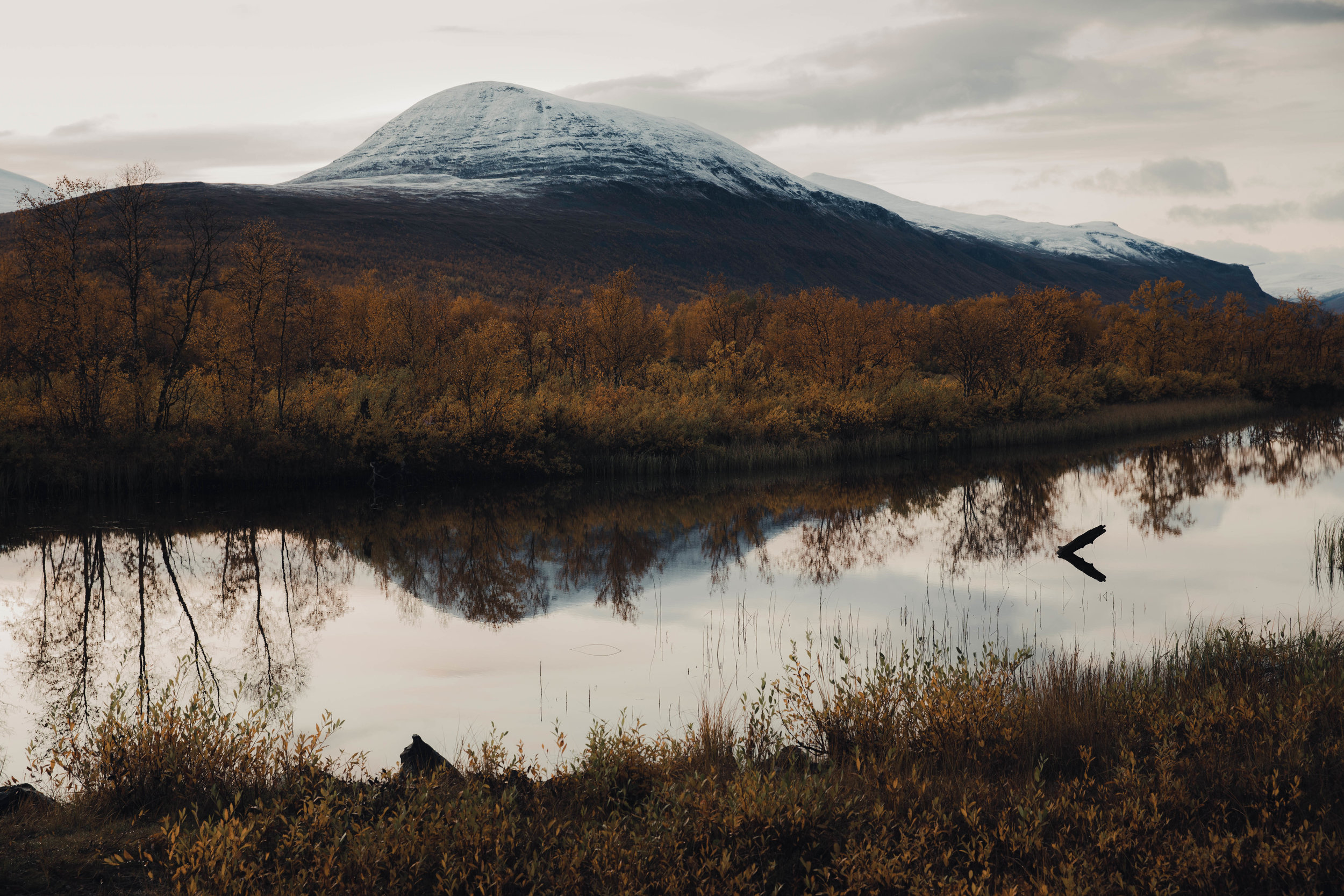
Autumn was coming to an end in Nikkaluokta.

Final stretch of the public road.

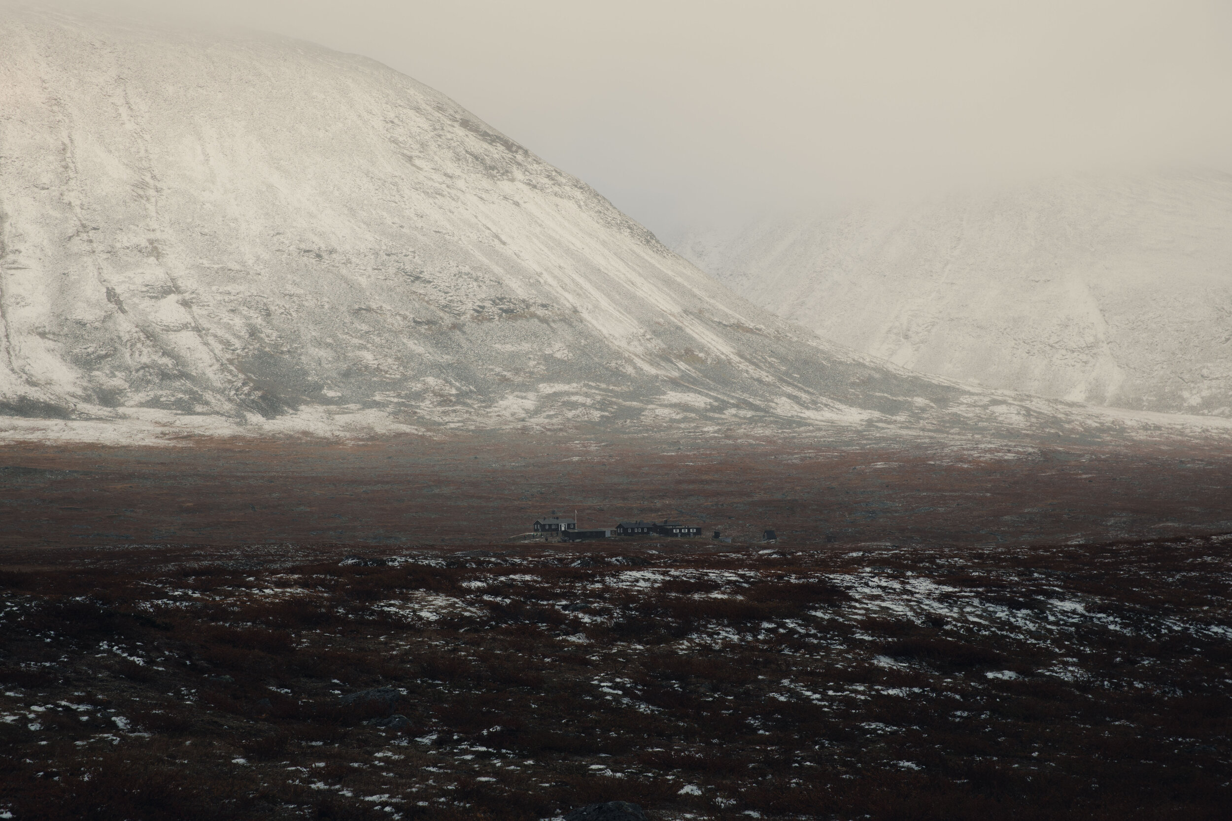
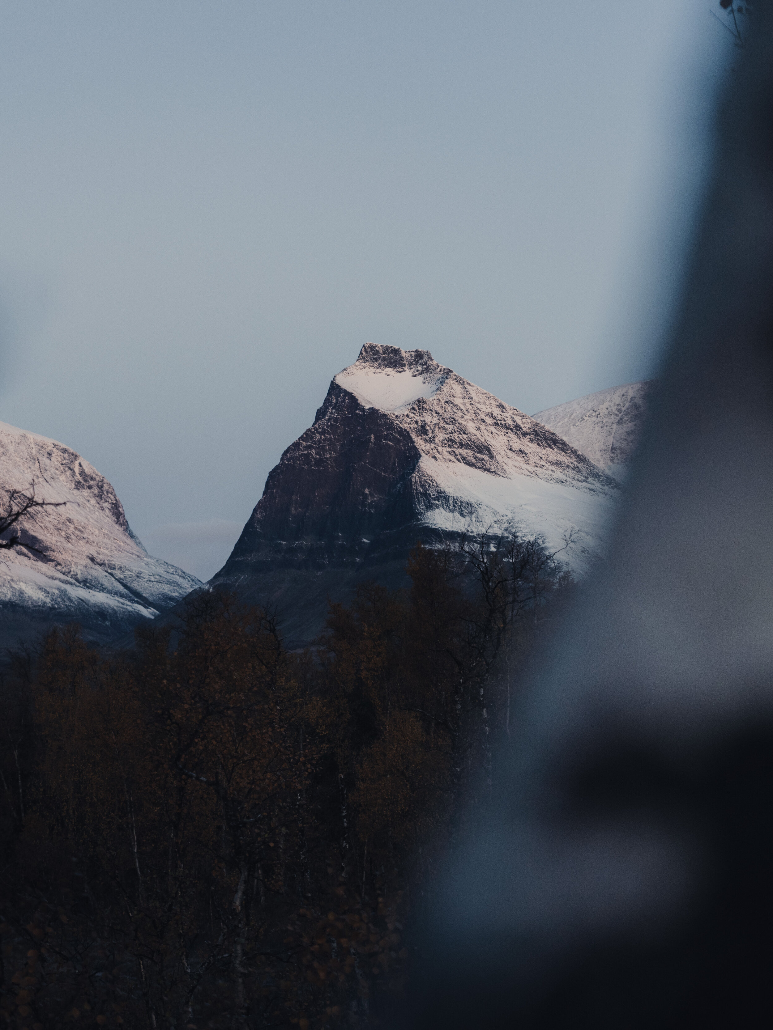
Mount Tuolpagorni with its characteristic crater on top measures 1662 meters (5453 ft). To the left of Tuolpagorni, mount Singitjåkka is visible at 1704 meters (5590 ft).
Day 1 | Nikkaluokta - Nallo by helicopter
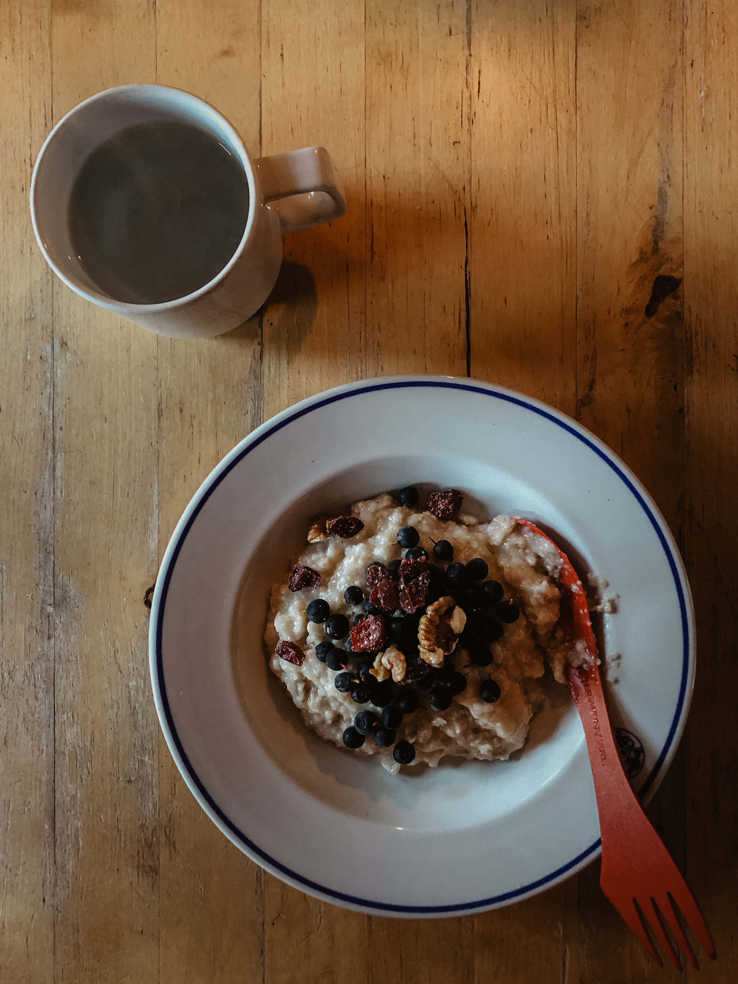
On day one we were off to an early start having our oatmeal in the self-service cabin. Soon after, we got picked up by a helicopter taking us for a short photography tour, before it dropped us off by the Nallo hut.
In Nallo winter was full-on and the temperature was negative 3 degrees Celsius (101,4 °F). We may have had the best possible start though since the host greeted us with home-made sponge cake and boiled coffee.
Every hut has at least one host from the Swedish Tourist Association. They’ll provide you with a bed for the night and all the info you’ll need.

Jacob making sure his adjustments are correct before take-off. In the front-passenger seat there was a small window to shoot from.

Vistas Valley (top) and delta next to Nikkaluokta (bottom).

These glacier lakes were a sight for sore eyes.

Red sediments.

Flying into the Nallo area.
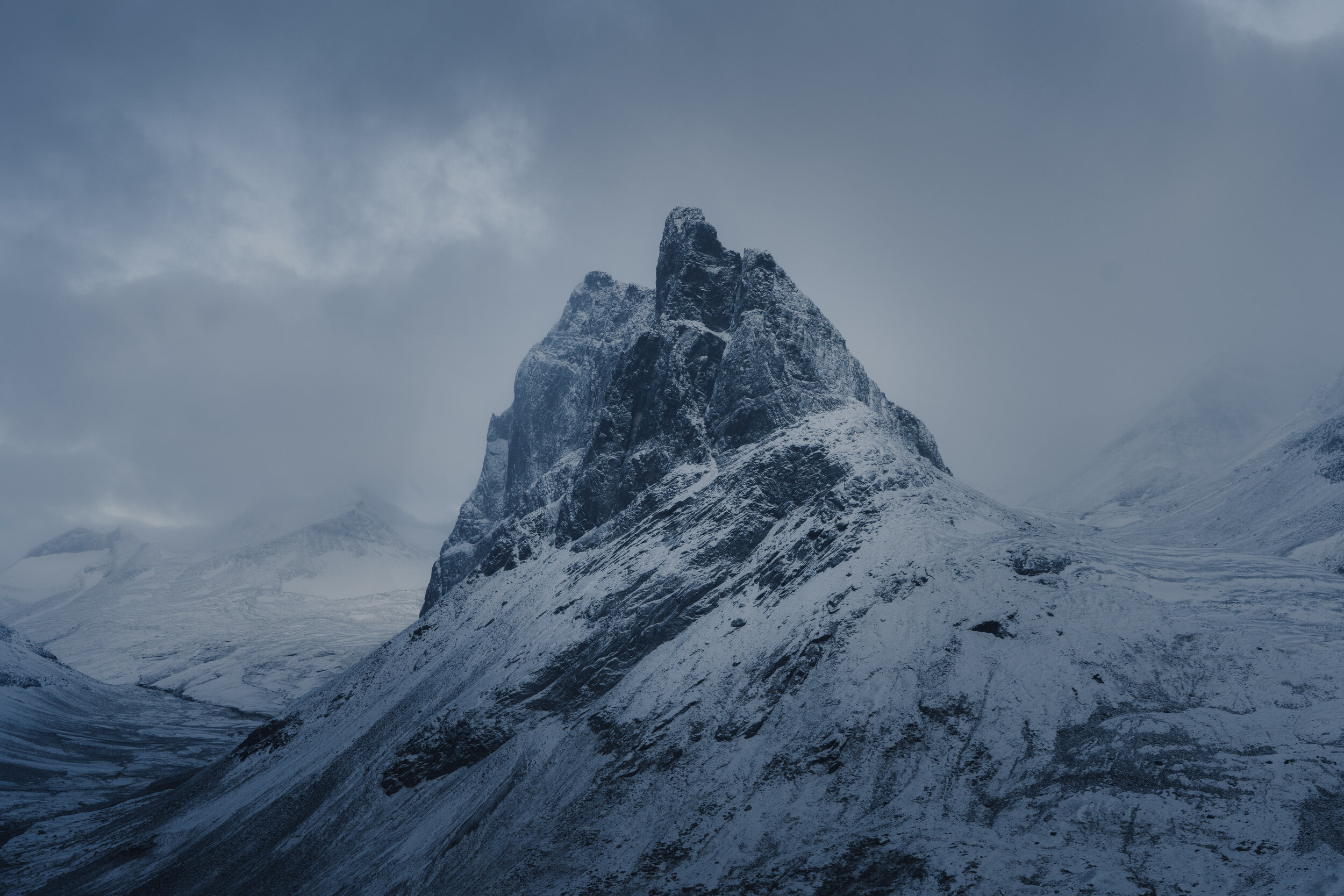
The Nallo Mountain with its sharp appearance - has given it its Sami name, which in English translates to The Needle

Enjoying sponge cake and hot boiled coffee.

Drop-off location.

The Nallo hut looking small below the steep mountain sides.
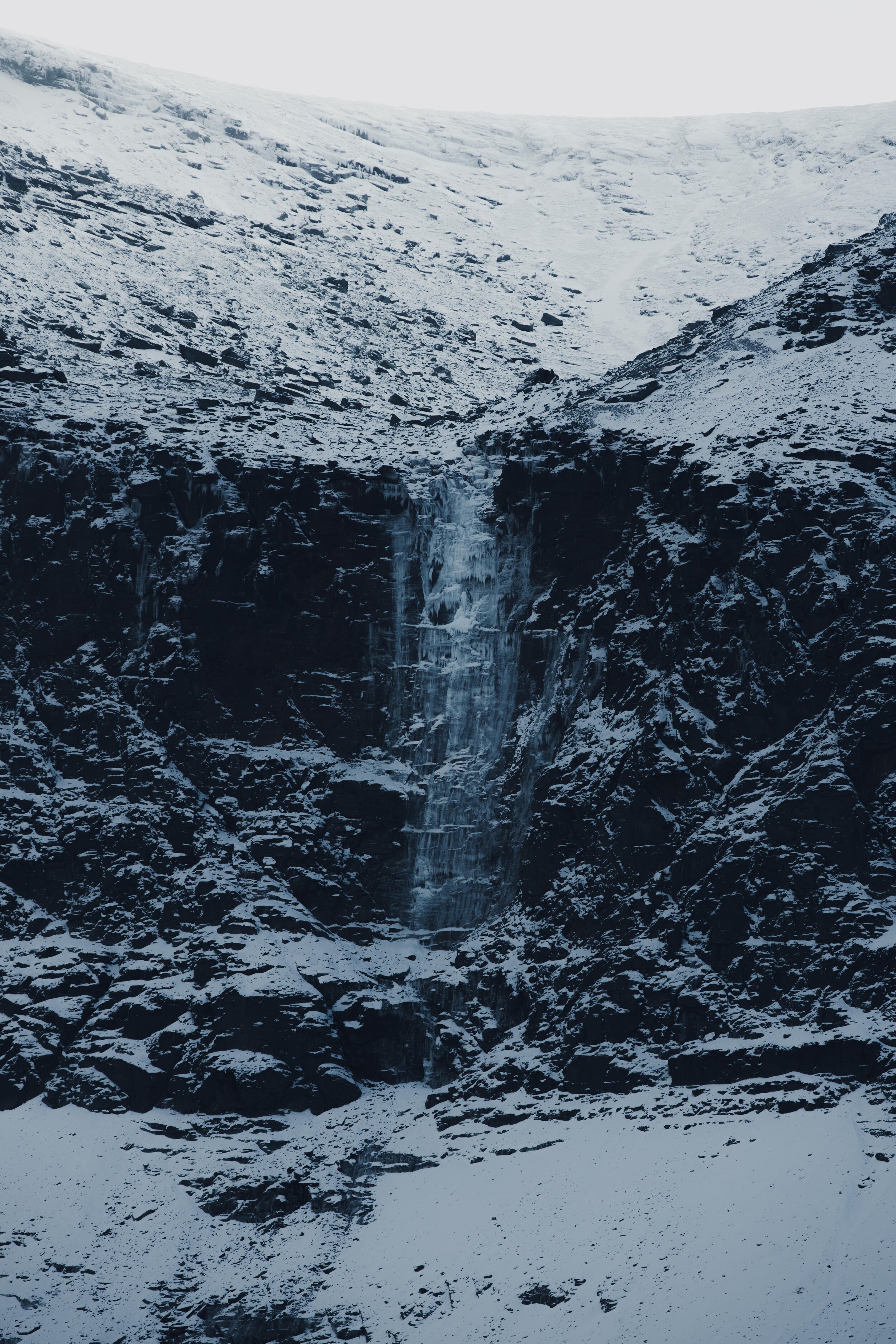
Before starting our hike toward Sälka, we explored around the Nallo area and went to the waterfall visible from the hut. It never ceases to surprise me how little elevation is needed for getting a completely different view. Shooting the hut from this spot is the perfect way of capturing the scale of the surrounding mountains. Next to the waterfall you’ll also find lesser-known trails with the possibility of reaching nearby huts.

The waterfall near Nallo still lacking a name to this date.

View from inside the Nallo hut.
Day 1 | Nallo - Sälka
Difficulty level: Easy
Length: 10km (6.2 miles)
Duration: 3h (photography stops not included)
Back from the waterfall, we warmed ourselves up inside before heading out on the first day of hiking. We made sure to leave by noon in order to reach the Sälka huts a few hours before sunset. This ten kilometer stretch proved to be tougher than expected due to the amount of big blocks of rock on the trail. The GPS indicated a trail fifty meters to the left of the river and it was pretty hard to see any trail at all because of the snow. Eventually, we realized there was a trail alongside the river which from that point on made the hiking a lot easier.
Overall, this route is probably one of the most beautiful stretches in Swedish Lapland, with high mountains surrounding the valley from all sides. We managed to get a few shots even though the visibility was limited.

Game of Thrones. We couldn’t help but notice the resemblance with the winter-scene environments in Game of Thrones when hiking through this mountain pass.

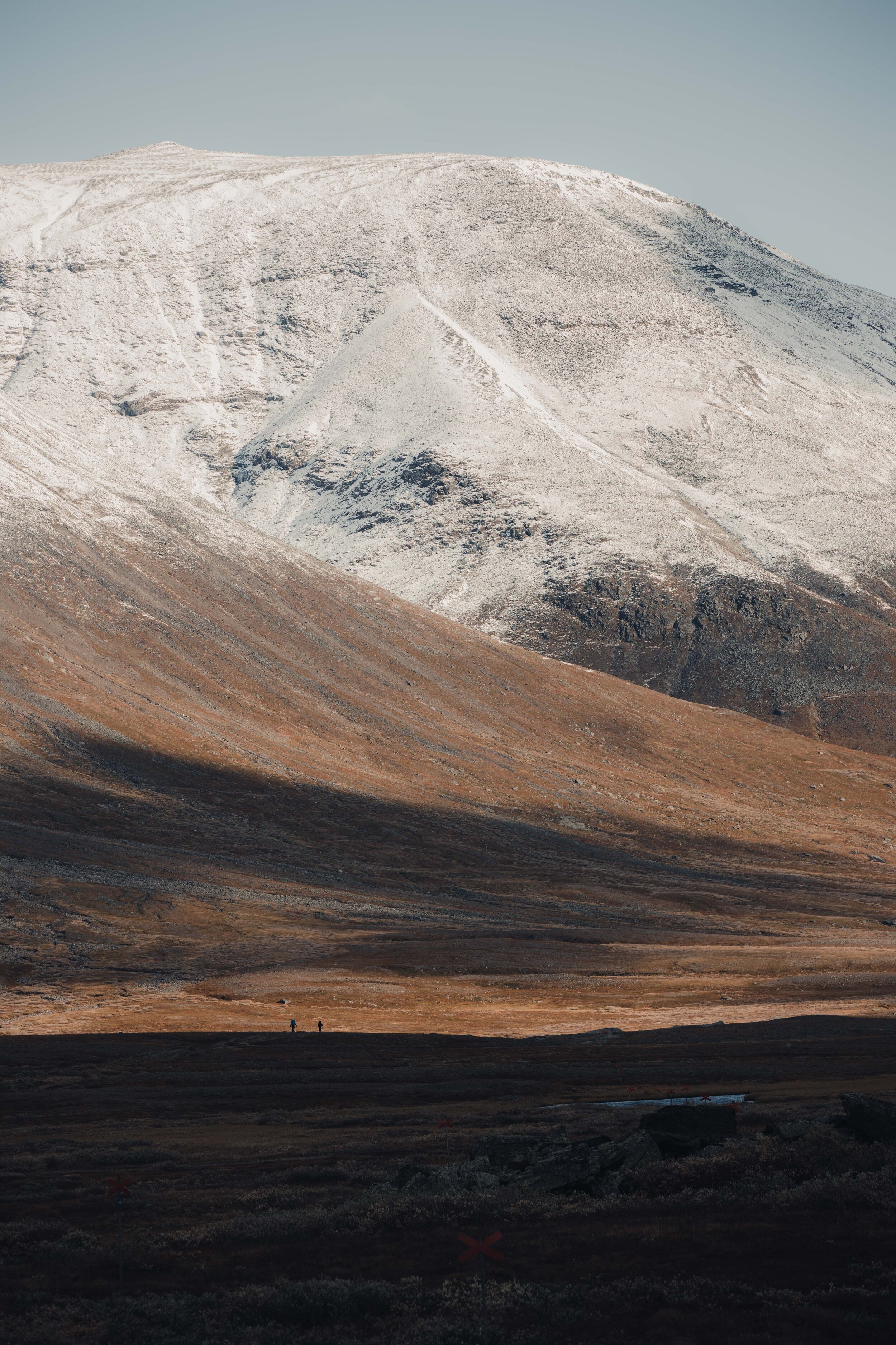
Surrounded by several mountains over 1500 meters (4920 feet).
Reaching the Sälka huts.
In the Sälka hut we rested up and had dinner. We didn’t wait long to start the firewood stove in our room since it was no more than 12 °C.
Before sunrise, we had a walk around the area trying to reach another waterfall - but fell short due to the water levels in the rivers. Back at the hut, the night was cold despite our firewood stove - but as always when hiking - falling asleep is never really an issue.
The Sälka huts accommodate 54 people but this late into the season you can expect only a handfull of hikers.

River crossing was difficult and time-consuming.
The Sälka huts seen from the east.

Inside Sälka. Firewood stoves are installed in all rooms including the kitchen.
Day 2 | Sälka - Singi
Difficulty level: Easy
Length: 12km (7.5 miles)
Duration: 4h (photography stops not included)
On day 2 we slowly digested our oatmeal and tea before picking up some extra chocolate bars from the store of Sälka. A few of the huts are equipped with basic provision and some hiking necessities.
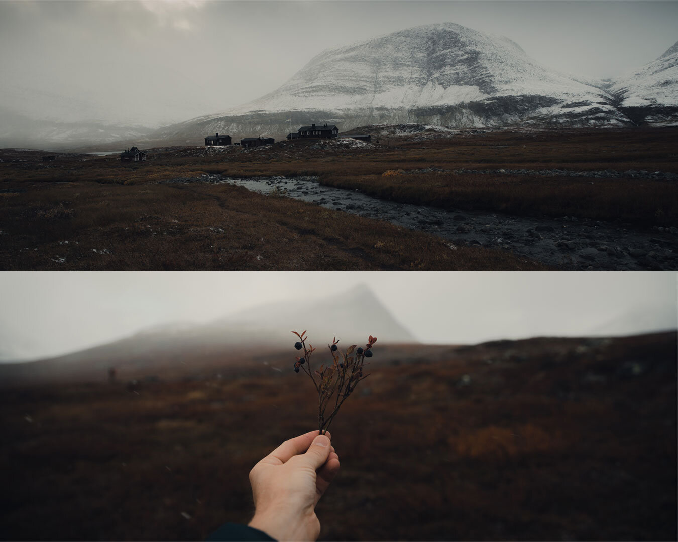
Back on the trail, we shot some aerials before going full steam ahead. The trail was pretty flat and the valley wide. You’ll pass by some suspension bridges where it’s easy to fill up with fresh water from below. We stopped for blueberries a few times and were surprised that they had survived the autumn cold this long, and still had a lot of taste left in them. It was such a treat having a different taste in your mouth after been resorted to dried food.
Since we’ve made som research we knew there was a pretty good chance of seeing reindeer by the end of the stretch, and so we did. They were pretty shy but we managed to get one or two decent shots of them. This spot is also an intersection where you have the option to head straight to the summit of Kebnekaise via the Coffee Valley (kaffedalen).
At ten kilometres we reached a canyon (only a few minutes detour) were we stopped to shoot. Back on the trail and just 100 meters down the slope it was like stepping into a painting. A Sami summer settlement with a twenty-something houses are located by a beautiful delta down the valley. The vast landscape and with almost no wind made the whole experience really special.
We hiked parallell with the delta for another fifteen minutes before reaching the Singi huts beautifully situated further in the valley.
After enjoying some sunny minutes at the hut and fueling up we went out for some blue hour photographing but we were struggling without tripods. For breakfast the morning after we had oatmeal, this time with blueberries which we had picked they day before.


Delta aerials. The sälka huts seen from above (middle).

We found some pretty wild canyons.

Jacob resting up before the final stretch.


The Sami summer settlement was all quiet since we were quite far into fall.


Blue hour snaps.


Day 3 | Singi - Kebnekaise
Difficulty level: Easy
Length: 14km (8.7 miles)
Duration: 5h (photography stops not included)
The start of this hike was the toughest so far with 2,5 kilometres uphill. The winter was well present and the wind hit us hard at times. Eventually, the trail flattens out and you’ll be hiking between high mountain sides for many miles. Since the sun hardly makes it over the peaks this time of the year it gets pretty chilly at times.
After about 8 kilometres the trail bends to the left and the valley opens up. It didn’t take us long before we ran into the next herd of reindeers. Excited about making it close to the reindeers, we photographed like crazy under the howling wind. At this point Jacob thanked his lucky star for the gloves he was lended by the helicopter pilot.
Back on the trail again everything passed much smoother with the soft grassy ground under our feet. About two kilometres from the Kebnekaise mountain station you’ll get a really good view of the iconic mountain of Tuolpagorni along with the “dragons back” of Kebnekaise towering behind with its highest point at 2096 meters - the highest mountain in Sweden. The south summit consists of a glacier and was until last year the highest point, but due to the record warm summer of 2018, that’s no longer the case. From the mountain station you’re able to do day hikes up to the summit, with or without a guide. The easiest trail, which is from the west side (västra leden) is 9 kilometres long with an elevation of 1800 meters. It will take approximately 10-14 hours up and down. Dress warmly though, since it’s likely to be considerably colder at the summit than down by the campsite.
About a kilometre from the Kebnekaise mountain station you’ll descend down to the tree-line. What struck me at that point was the scent of sun-warmed soil for the first time during the trip. And it was such a familiar scent - similar to when the snow gives away for spring with its earthy notes.

Lapland reindeers roaming the vast Northern land.


Mount Tuolpagorni with its cauldron-like looking summit.

At the Kebnekaise mountain station we treated ourselves with a hot meal from the restaurant. Chili con carne has never tasted so good. A bit of down-time was over-due, so we relaxed in our cosy (yes, actually) 4-bed dorm, had a much-needed shower and a hot dried meal. We went out to shoot but the light wasn’t really on our side. We decided to tuck in early since we were going to start at 5:30 am the day after.
The Kebnekaise mountain station is fully equipped with restaurant, bar and wi-fi, and therefore is more expensive than the standard huts which are around 50€ for members of STF ( The Swedish Tourist Association). The Kebnekaise Mountain Station is also much busier than other huts since it attracts climbers and alpinists from all around the world.
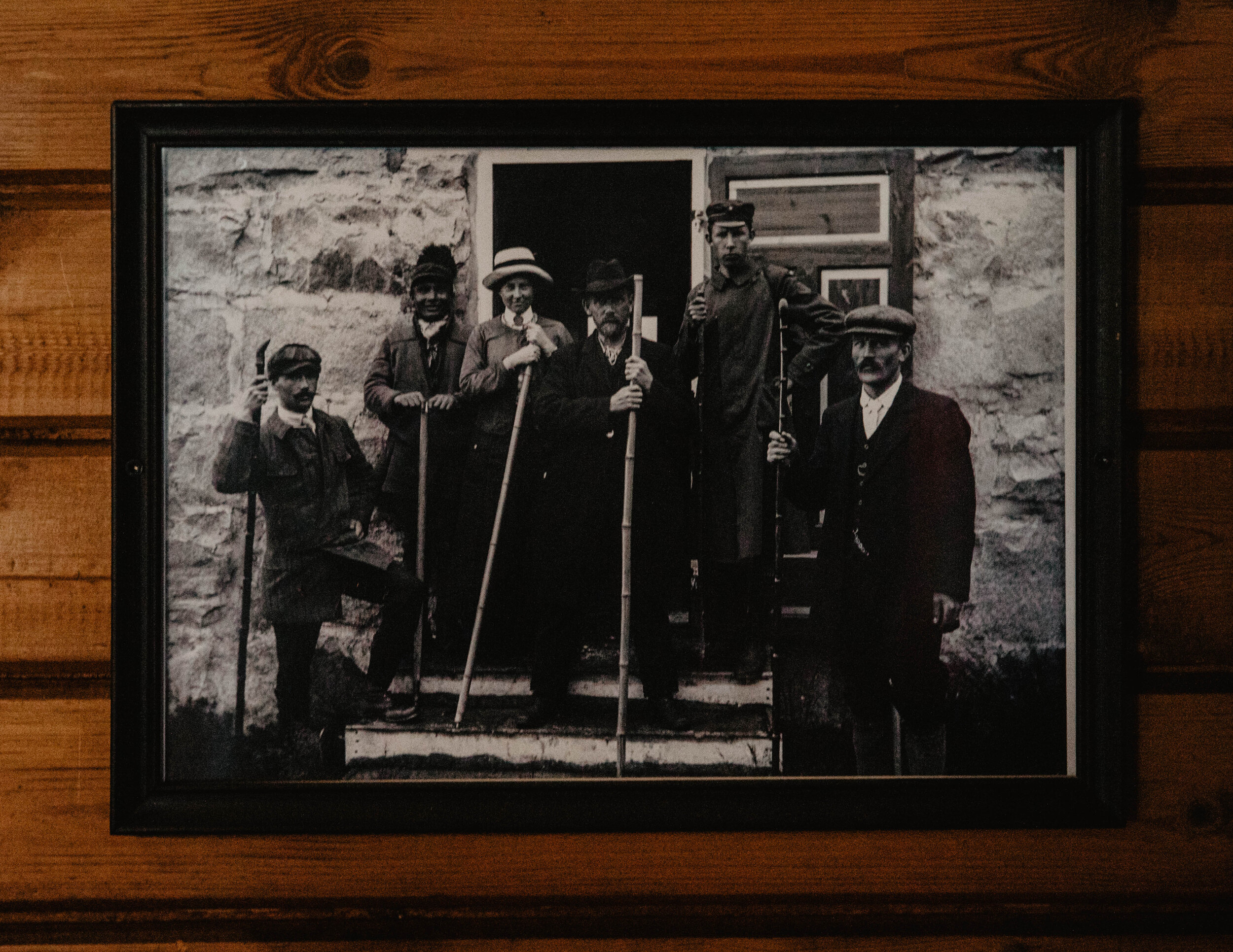
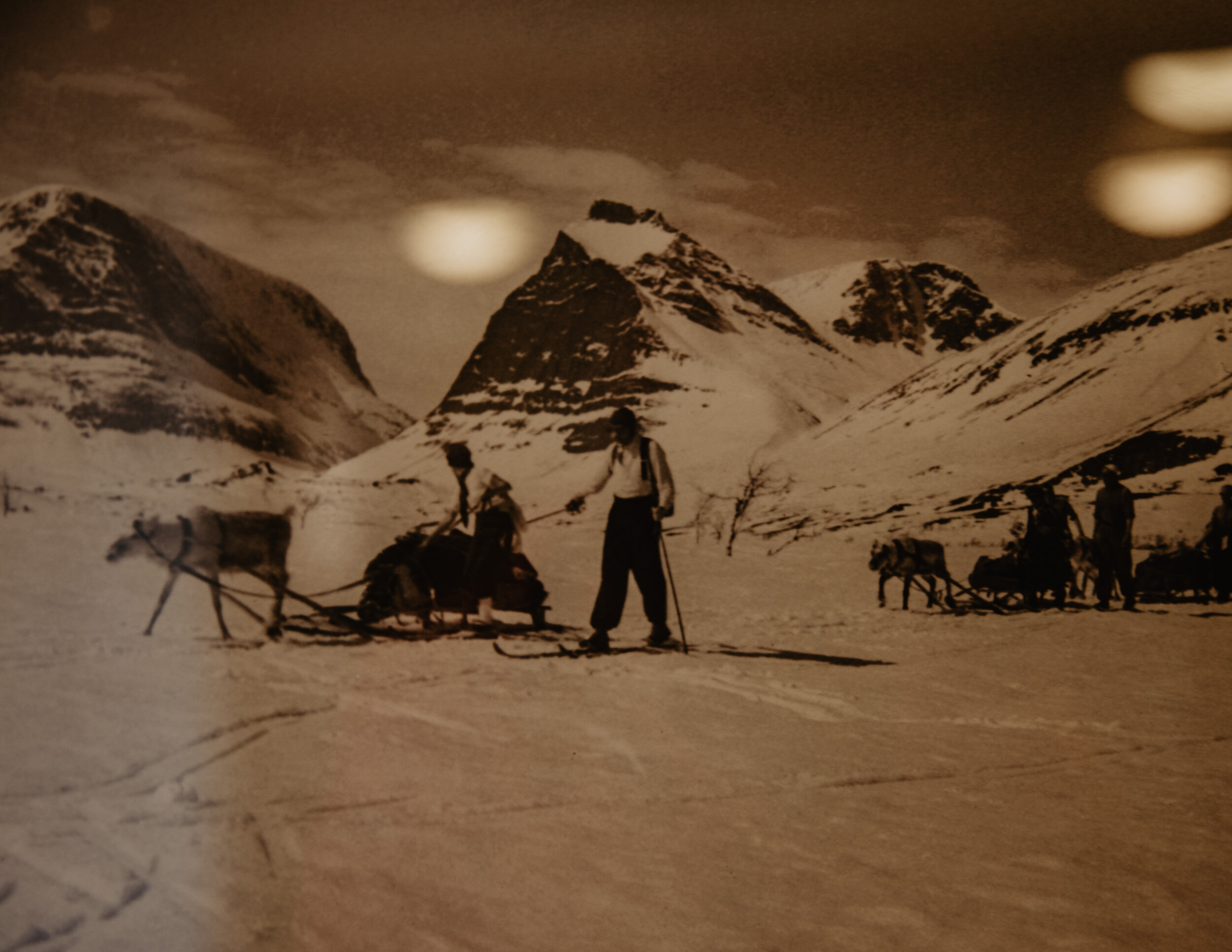
Old photographs from the Kebnekaise mountain station and the surrounding area. The hut was installed in 1908. On top of Kebnekaise there are two emergency cabins.

Cosy bed sites. Our place for the night.
Sunset viewed from the Kebnekaise mountain station.
Day 4 | Kebnekaise - Nikkaluokta
Difficulty level: Easy
Length: 19km (11.8 miles)
Duration: 4.5h (photography stops not included)
Early the next morning the footbridges were icy and slippery as the temperature had dropped a few degrees below zero during the night. The air was crisp and fresh though and after a shower and a good nights sleep the day before, we felt energized and ready to take on the longest stretch of the trail.
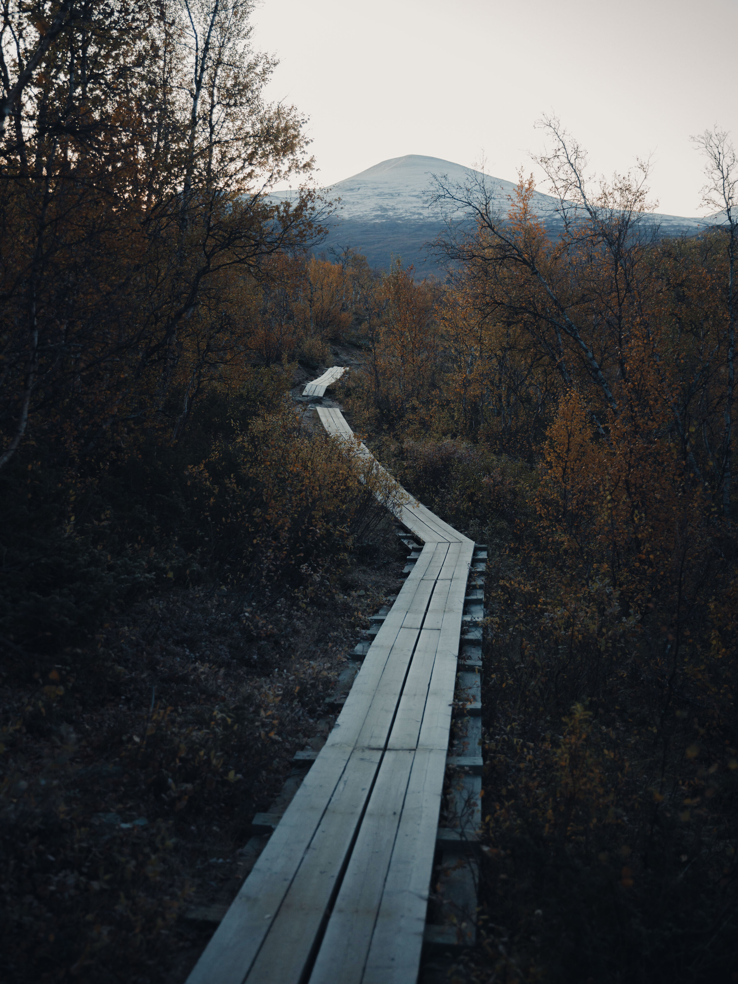
The first 4 kilometres were slightly downhill and didn’t take us long to finish. On this first bit you get a slightly different angle of Tuolpagorni and nice leading lines from the footbridges. 1,5 hours into the hike we experienced the first real sunrise so far, so we rushed down to a small lake sending up the drone.
After 8 kilometres you’ll reach a spot where you have the option to pay for a boat to take you over the turquoise-looking mountain lake named Láddjujávri. Taking this route also means you’ll shorten the hike by six kilometres. At this time of year the boats have stopped for the season so we had no other choice than to keep on walking.
Not much was going on photo-wise on the remaining 11 kilometres but we were lucky enough to bump into another reindeer herd.
The last bit went surprisingly easy and soon we reached Nikkaluokta, tired but pretty happy to have completed our journey. In Nikkaluokta we picked up our laptops from the storage and had time to freshen up before jumping on the shuttle bus to the airport. Lapland you definitely our hearts away!
This was the very last day of the hiking season before all the huts closed. This means fewer people on the trail and if you’re lucky the intense orange colours are still around. We were probably a week too late for the best photography conditions, but on the other hand we got full-on winter in the mountain area of Nallo.

Suspicious. This reindeer seemed skeptical as Jacob pulled out his zoom lens.

Drone operation during sunrise.


Sunrise over the Láddjuvággi delta.